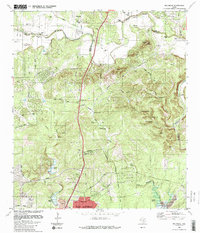
1988 Map of Bulverde
USGS Topo · Published 1988About this map
Cibolo Creek meanders through the limestone terrain of the Hill Country on the border of Comal and Bexar counties, anchoring a landscape shaped by rural family legacies and German-Texan heritage. The map documents the community of Bulverde and its surrounding hinterlands during the late 1980s, a period when cattle ranching and early residential development coexisted. Family names are etched into the land through a high concentration of private cemeteries, including the Schlather, Hitzfelder, Weidner, and Voges cemeteries, providing a detailed resource for genealogical research.
Find a feature on this map
45 named features on this map. Tap any name to fly to it.
Don’t see what you’re looking for? This feature index may not catch every label — zoom into the map to look around manually.
Map Details
Editions of this 1988 Bulverde Map
This is the sole edition of this map. No revisions or reprints were ever made.
Other maps of this area

1920 · Smithsons Valley
USGS Topo · 1:62,500

1927 · Smithson Valley
USGS Topo · 1:62,500

1929 · Smithson Valley
USGS Topo · 1:62,500

1940 · Smithson Valley
USGS Topo · 1:62,500

1953 · Otis Ridge
USGS Topo · 1:24,000

1953 · Schertz
USGS Topo · 1:24,000

1953 · Bulverde
USGS Topo · 1:24,000

1953 · Bat Cave
USGS Topo · 1:24,000

1953 · Longhorn
USGS Topo · 1:24,000

1953 · Castle Hills
USGS Topo · 1:24,000