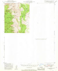
1947 Map of Bumblebee
USGS Topo · Published 1955About this map
Mining operations and remote ranching outposts define this 1940s landscape within the Prescott National Forest and the eastern slopes of the Bradshaw Mts. High-desert terrain is marked by a legacy of extraction, evidenced by the Thunderbolt Mine, Howard Silver Mine, and Howard Copper Mine. The small settlement of Bumblebee sits nestled along Bumblebee Creek, supported by several windmills and connected to the wider world by a telephone line. Further south, Cordes Cabin serves as a lone landmark in a network of deep drainage systems like Black Canyon and Rattlesnake Canyon. This era shows the region before modern development, where water sources like Sheep Spr and Mud Spr were critical for livestock and survival in the Yavapai backcountry.
Find a feature on this map
42 named features on this map. Tap any name to fly to it.
Don’t see what you’re looking for? This feature index may not catch every label — zoom into the map to look around manually.
Map Details
Editions of this 1947 Bumblebee Map
2 editions found

Other maps of this area

1887 · Verde
USGS Topo · 1:250,000

1887 · Prescott
USGS Topo · 1:250,000

1892 · Verde
USGS Topo · 1:250,000

1892 · Prescott
USGS Topo · 1:250,000

1903 · Bradshaw Mountains
USGS Topo · 1:125,000

1929 · Turret Peak
USGS Topo · 1:125,000

1930 · Cave Creek
USGS Topo · 1:125,000

1933 · Turret Peak
USGS Topo · 1:125,000

1939 · Cave Creek
USGS Topo · 1:125,000

1947 · Crown King
USGS Topo · 1:62,500