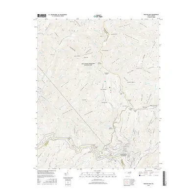
2016 Map of Bunches Bald
USGS Topo · Published 2016About this map
The high ridges of Great Smoky Mountains National Park dominate this terrain where Swain, Haywood, and Jackson Counties converge. The landscape is defined by its massive peaks and gap crossings, including Potato Hill Bald, Heintooga Bald, and Cataloochee Balsam. Significant engineering feats are visible along the southern edge, where the Blue Ridge Parkway winds through the mountains, passing through the Big Witch Tunnel, Bunches Bald Tunnel, and Lickstone Ridge Tunnel. For those researching local history, the McGhee Cem is situated in the northwest, near the waters of Quillaree Br. The map highlights a network of vital access points and trails like Polls Gap and the Balsam Mountain Road, which follow the high ground of Ravens Roost Ridge and Chiltoskie Ridge. Small watercourses such as Straight Fork Raven Fork and Flat Creek Falls drain these steep slopes, illustrating the complex hydrology of the Great Smoky Mountains.
Find a feature on this map
149 named features on this map. Tap any name to fly to it.
Don’t see what you’re looking for? This feature index may not catch every label — zoom into the map to look around manually.
Map Details
Editions of this 2016 Bunches Bald Map
This is the sole edition of this map. No revisions or reprints were ever made.
Other maps of this area

1891 · Cowee
USGS Topo · 1:125,000

1893 · Mt Guyot
USGS Topo · 1:125,000

1897 · Cowee
USGS Topo · 1:125,000

1907 · Cowee
USGS Topo · 1:125,000

1912 · Mt Guyot
USGS Topo · 1:125,000

1933 · Bryson
USGS Topo · 1:62,500

1935 · Dellwood
USGS Topo · 1:24,000

1935 · Hazelwood
USGS Topo · 1:24,000

1935 · Addie
USGS Topo · 1:24,000

1936 · Bunches Bald
USGS Topo · 1:24,000