1976 Map of Bunches Bald
USGS Topo · Published 1978About this map
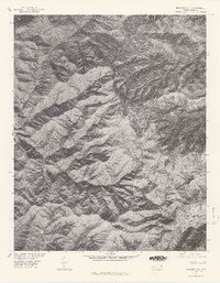
Bunches Bald and the surrounding heights of the Great Smoky Mountains are shown here as they appeared in the mid-1970s through this orthophotoquad. Produced in cooperation with the Bureau of Indian Affairs, the imagery documents a landscape defined by steep, timbered ridges and narrow watercourses. The drainage patterns of Straight Fork and Raven Fork are visible as they cut through the terrain below Balsam Mountain and Cataloochee Balsam. Significant topographical landmarks such as Chiltoskie Ridge and Chesnut Ridge provide clear evidence of the area's geological character. This map serves as a photographic record of the high-elevation forest and topography before later decades of environmental change, capturing the specific state of Spruce Mountain and Barnett Knob during a 1976 aerial survey.
Find a feature on this map
9 named features on this map. Tap any name to fly to it.
Don’t see what you’re looking for? This feature index may not catch every label — zoom into the map to look around manually.
Map Details
Editions of this 1976 Bunches Bald Map
This is the sole edition of this map. No revisions or reprints were ever made.
Other maps of this area

1891 · Cowee
USGS Topo · 1:125,000

1893 · Mt Guyot
USGS Topo · 1:125,000

1897 · Cowee
USGS Topo · 1:125,000

1907 · Cowee
USGS Topo · 1:125,000

1912 · Mt Guyot
USGS Topo · 1:125,000

1933 · Bryson
USGS Topo · 1:62,500

1935 · Dellwood
USGS Topo · 1:24,000

1935 · Hazelwood
USGS Topo · 1:24,000

1935 · Addie
USGS Topo · 1:24,000

1936 · Bunches Bald
USGS Topo · 1:24,000