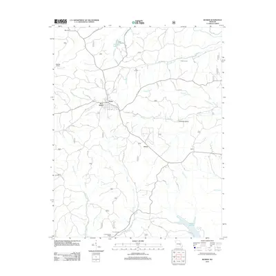
2012 Map of Bunker
USGS Topo · Published 2012About this map
Bunker and its western extension, West Bunker, anchor this portion of the eastern Ozarks, serving as a hub for a network of rural roads including State Hwy P and Cemetery Rd. The landscape is deeply etched by watercourses like the Bee Fork, Big Creek, and the winding Adair Creek, which flows toward Number 51 Lake. To the south, Turner Natural Bridge offers a distinct geological landmark near the banks of Big Creek, not far from the Turner Cemetery. This 2012 survey illustrates a region where small settlements like Melton and Lily Farm are tucked between hollows such as Ottawa Hollow and Jayhawker Hollow. For those studying the area's social geography, the placement of the Estep Cemetery and Parks Cemetery along the ridges above Toms Creek provides essential context for local family history and the distribution of early hill-country communities.
Find a feature on this map
49 named features on this map. Tap any name to fly to it.
Don’t see what you’re looking for? This feature index may not catch every label — zoom into the map to look around manually.
Map Details
Editions of this 2012 Bunker Map
This is the sole edition of this map. No revisions or reprints were ever made.
Other maps of this area

1941 · Stone Hill
USGS Topo · 1:62,500

1943 · Boss
USGS Topo · 1:62,500

1944 · Corridon
USGS Topo · 1:62,500

1945 · Stone Hill
USGS Topo · 1:62,500

1945 · Round Spring
USGS Topo · 1:62,500

1946 · Boss
USGS Topo · 1:62,500

1947 · Sinkin
USGS Topo · 1:48,000

1947 · Corridon
USGS Topo · 1:62,500

1949 · Round Spring
USGS Topo · 1:62,500

1949 · Rolla
USGS Topo · 1:250,000