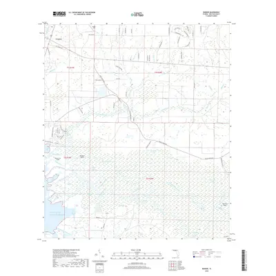
2018 Map of Bunker
USGS Topo · Published 2018About this map
Freeport sits at the northern edge of this coastal landscape, where the waters of Lafayette Cr and Ramsey Br meet the head of Jolly Bay. The southern half of the map is dominated by the intricate wetlands and distributaries of the Choctawhatchee River delta, a complex environment of marshes and channels including the Blue Oak Cutoff and the Mitchell River. This riverine system creates a network of named landmasses such as Opossum Island, Bunker Island, and Indian Island before finally emptying into Choctawhatchee Bay and the Gulf of Mexico.
Find a feature on this map
89 named features on this map. Tap any name to fly to it.
Don’t see what you’re looking for? This feature index may not catch every label — zoom into the map to look around manually.
Map Details
Editions of this 2018 Bunker Map
This is the sole edition of this map. No revisions or reprints were ever made.
Other maps of this area

1935 · De Funiak Springs
USGS Topo · 1:48,000

1936 · Point Washington
USGS Topo · 1:48,000

1938 · De Funiak Springs
USGS Topo · 1:62,500

1939 · Point Washington
USGS Topo · 1:62,500

1943 · Seminole Hills
USGS Topo · 1:24,000

1944 · Seminole Hills
USGS Topo · 1:31,680

1944 · Bruce
USGS Topo · 1:24,000

1945 · Bruce
USGS Topo · 1:31,680

1949 · Redbay
USGS Topo · 1:24,000

1950 · Redbay
USGS Topo · 1:24,000