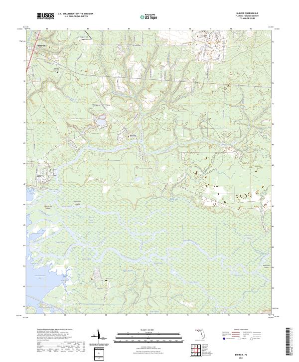
2024 Map of Bunker
USGS Topo · Published 2024About this map
Freeport serves as the gateway to this intricate aquatic landscape where the Choctawhatchee River fragments into a network of islands and bayous. The map documents the complex hydrology of the region, featuring Bunker Island, Nancys Cut Island, and Opossum Island set within the river's delta as it reaches Choctawhatchee Bay. Family and local history are anchored by several upland sites, including Roache Hill Cem and Black Creek Memorial Cem, while the southern reaches show the remote Bunker Cem near Bunker Cove. The transition from the established settlement of Freeport to the swampy wetlands along the Sister River and Live Oak Cutoff illustrates the geographic divide between the area's developed pine woods and the seasonally flooded river bottoms.
Find a feature on this map
89 named features on this map. Tap any name to fly to it.
Don’t see what you’re looking for? This feature index may not catch every label — zoom into the map to look around manually.
Map Details
Editions of this 2024 Bunker Map
This is the sole edition of this map. No revisions or reprints were ever made.
Other maps of this area

1935 · De Funiak Springs
USGS Topo · 1:48,000

1936 · Point Washington
USGS Topo · 1:48,000

1938 · De Funiak Springs
USGS Topo · 1:62,500

1939 · Point Washington
USGS Topo · 1:62,500

1943 · Seminole Hills
USGS Topo · 1:24,000

1944 · Seminole Hills
USGS Topo · 1:31,680

1944 · Bruce
USGS Topo · 1:24,000

1945 · Bruce
USGS Topo · 1:31,680

1949 · Redbay
USGS Topo · 1:24,000

1950 · Redbay
USGS Topo · 1:24,000