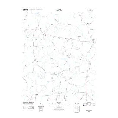
2013 Map of Bunn West
USGS Topo · Published 2013About this map
The agrarian landscape of Franklin County is defined by a dense network of country roads and small communities at the start of the 21st century. New Hope and Five Points serve as local hubs along the east-west corridor of NC-98, while the town of Bunn anchors the eastern edge of the survey near Bunn Elementary School Rd. The region's history is written in its family-named roads and water features, from Hales Store Rd to the winding course of Moccasin Cr. Small-scale aviation is represented by Riley Field Airport, situated near the settlement of Riley. The drainage patterns of Norris Cr and Crooked Cr continue to shape the terrain, punctuated by local landmarks like Privetts Pond and Bakers Pond that likely served generations of local residents and farmers.
Find a feature on this map
166 named features on this map. Tap any name to fly to it.
Don’t see what you’re looking for? This feature index may not catch every label — zoom into the map to look around manually.
Map Details
Editions of this 2013 Bunn West Map
This is the sole edition of this map. No revisions or reprints were ever made.
Other maps of this area

1902 · Spring Hope
USGS Topo · 1:62,500

1904 · Springhope
USGS Topo · 1:62,500

1953 · Raleigh
USGS Topo · 1:250,000

1953 · Greensboro
USGS Topo · 1:250,000

1954 · Greensboro
USGS Topo · 1:250,000

1954 · Raleigh
USGS Topo · 1:250,000

1962 · Greensboro
USGS Topo · 1:250,000

1966 · Greensboro
USGS Topo · 1:250,000

1967 · Knightdale
USGS Topo · 1:24,000
1967 · Rolesville
USGS Topo · 1:24,000