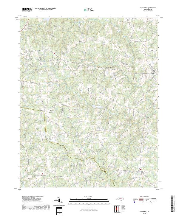
2022 Map of Bunn West
USGS Topo · Published 2022About this map
Bunn and its surrounding communities in rural Franklin Co and Wake Co are defined by a network of creeks and legacy farm roads. This landscape is shaped by the headwaters of the Little River and the winding course of Moccasin Cr, which forms a significant portion of the county boundary. Smaller settlements such as Pearces, Riley, and Hopkins are scattered across the terrain, connected by historical thoroughfares like Tarboro Rd and Old Halifax Rd.
Find a feature on this map
136 named features on this map. Tap any name to fly to it.
Don’t see what you’re looking for? This feature index may not catch every label — zoom into the map to look around manually.
Map Details
Editions of this 2022 Bunn West Map
This is the sole edition of this map. No revisions or reprints were ever made.
Other maps of this area

1902 · Spring Hope
USGS Topo · 1:62,500

1904 · Springhope
USGS Topo · 1:62,500

1953 · Raleigh
USGS Topo · 1:250,000

1953 · Greensboro
USGS Topo · 1:250,000

1954 · Greensboro
USGS Topo · 1:250,000

1954 · Raleigh
USGS Topo · 1:250,000

1962 · Greensboro
USGS Topo · 1:250,000

1966 · Greensboro
USGS Topo · 1:250,000

1967 · Knightdale
USGS Topo · 1:24,000
1967 · Rolesville
USGS Topo · 1:24,000