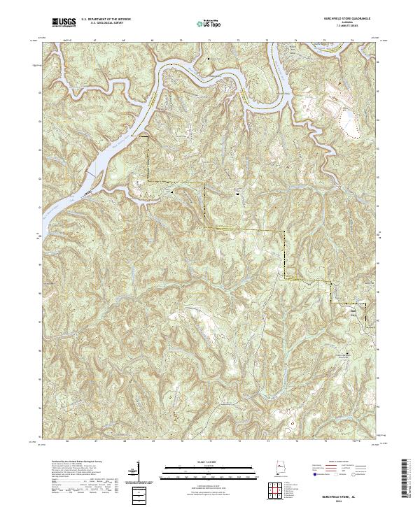
2024 Map of Burchfield Store
USGS Topo · Published 2024About this map
The Black Warrior River carves a deep, winding path through this portion of Alabama, where the boundaries of Jefferson and Tuscaloosa Counties meet. This riverine landscape is defined by its historic water crossings and high ridges, including Patton Ferry and Howtons Ferry which once linked these rural communities across the water. The elevation rises sharply from the riverbanks to named heights such as Pumpkin Ridge and Iron Ore Mtn, reflecting a terrain that influenced both movement and settlement. Local history is anchored by several small communities and burial sites, including Bull City and Betty Hill in the east, and the Prudes Creek Baptist Church Cem to the south. Numerous named branches like Big Yellow Creek and Whiteoak Creek feed into the river system, while historical road names like Old Lock 17 Rd point to the area's navigational and industrial heritage along the river's locks and dams.
Find a feature on this map
91 named features on this map. Tap any name to fly to it.
Don’t see what you’re looking for? This feature index may not catch every label — zoom into the map to look around manually.
Map Details
Editions of this 2024 Burchfield Store Map
This is the sole edition of this map. No revisions or reprints were ever made.
Other maps of this area

1893 · Jasper
USGS Topo · 1:125,000

1899 · Brookwood
USGS Topo · 1:125,000

1927 · Adger
USGS Topo · 1:48,000

1929 · Searles
USGS Topo · 1:48,000

1932 · Yolande
USGS Topo · 1:62,500

1934 · Searles
USGS Topo · 1:62,500

1935 · Port Birmingham
USGS Topo · 1:48,000

1935 · Yolande
USGS Topo · 1:62,500

1938 · Port Birmingham
USGS Topo · 1:62,500

1949 · Tutwiler School
USGS Topo · 1:24,000