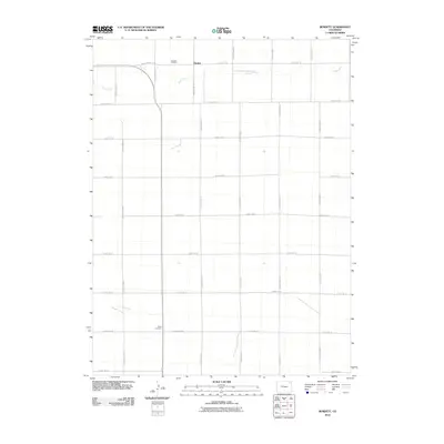
2010 Map of Burdett
USGS Topo · Published 2010About this map
Burdett sits at the center of this 2010 landscape in Washington County, a pocket of the eastern Colorado plains defined by a strictly organized grid of rural corridors. The settlement is anchored near the northern edge of the map, where Rock Creek meanders through the terrain, providing a natural break in the otherwise linear arrangement of County Rd 55 and County Rd 54. This area represents the enduring agricultural character of the region, where wide-open spaces are punctuated only by essential community landmarks. Genealogists and local historians can pinpoint the locations of Burdett Cemetery in the north and Hope Cemetery further south along County Rd 48, serving as quiet markers of the families who settled this high plains territory.
Find a feature on this map
20 named features on this map. Tap any name to fly to it.
Don’t see what you’re looking for? This feature index may not catch every label — zoom into the map to look around manually.
Map Details
Editions of this 2010 Burdett Map
This is the sole edition of this map. No revisions or reprints were ever made.
Other maps of this area

1954 · Sterling
USGS Topo · 1:250,000

1958 · Sterling
USGS Topo · 1:250,000

1972 · New Haven
USGS Topo · 1:24,000

1972 · Glacken Hill
USGS Topo · 1:24,000

1972 · Otis
USGS Topo · 1:24,000

1972 · Hyde
USGS Topo · 1:24,000

1972 · Lone Star
USGS Topo · 1:24,000

1972 · Burdett
USGS Topo · 1:24,000

1973 · Platner
USGS Topo · 1:24,000

1973 · Buffalo Springs Ranch NE
USGS Topo · 1:24,000