
1972 Map of Hyde
USGS Topo · Published 1975About this map
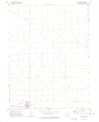
Hyde serves as the primary focal point of this 1970s topographic survey, situated in the High Plains where the Washington Co Yuma Co boundary line divides the landscape. The region's economic drivers are clearly delineated by the presence of the Hyde Oil Field and scattered Gravel Pits, alongside the heavy infrastructure of the Burlington Northern railroad. This rail line connects the small settlements of Suiter and Yuma Siding to the larger agricultural network.
Find a feature on this map
11 named features on this map. Tap any name to fly to it.
Don’t see what you’re looking for? This feature index may not catch every label — zoom into the map to look around manually.
Map Details
Editions of this 1972 Hyde Map
This is the sole edition of this map. No revisions or reprints were ever made.
Other maps of this area

1954 · Sterling
USGS Topo · 1:250,000

1958 · Sterling
USGS Topo · 1:250,000

1972 · Otis
USGS Topo · 1:24,000

1972 · Lone Star
USGS Topo · 1:24,000

1972 · Clarkville SW
USGS Topo · 1:24,000

1972 · Snyder Lake
USGS Topo · 1:24,000

1972 · Otis SE
USGS Topo · 1:24,000

1972 · Burdett
USGS Topo · 1:24,000

1972 · Yuma South
USGS Topo · 1:24,000
1972 · Yuma North
USGS Topo · 1:24,000