
1972 Map of Otis SE
USGS Topo · Published 1975About this map
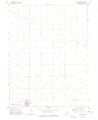
The Washington Co and Yuma Co boundary line bisects this 1970s landscape, revealing a vast high-plains terrain defined by subterranean water access. The map's most striking characteristic is the sheer density of groundwater infrastructure, with dozens of Well labels dotting the landscape across nearly every section of the grid. This pattern reflects the region's total dependence on irrigation and agricultural pumping in a semi-arid environment. Human industry is concentrated at a single Gravel Pit near the county line, while the remainder of the quadrangle is largely open, divided by a precise network of section lines and range boundaries. This survey provides a primary record of the rural land-use patterns and hydrological development in eastern Colorado during the early 1970s.
Find a feature on this map
3 named features on this map. Tap any name to fly to it.
Don’t see what you’re looking for? This feature index may not catch every label — zoom into the map to look around manually.
Map Details
Editions of this 1972 Otis SE Map
This is the sole edition of this map. No revisions or reprints were ever made.
Other maps of this area

1954 · Limon
USGS Topo · 1:250,000

1954 · Sterling
USGS Topo · 1:250,000

1957 · Limon
USGS Topo · 1:250,000

1958 · Limon
USGS Topo · 1:250,000

1958 · Sterling
USGS Topo · 1:250,000

1972 · Otis
USGS Topo · 1:24,000

1972 · Hyde
USGS Topo · 1:24,000

1972 · Snyder Lake
USGS Topo · 1:24,000

1972 · Yuma South
USGS Topo · 1:24,000
1972 · Yuma North
USGS Topo · 1:24,000