
1972 Map of Clarkville SW
USGS Topo · Published 1975About this map
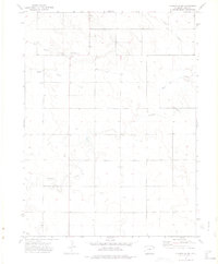
Red Willow Community Center serves as a lone social focal point in this expansive high plains landscape within Yuma County. Surveyed in the early 1970s, the terrain is defined by a dendritic network of intermittent drainage ways, including Red Willow Creek, Rock Creek, and Surveyor Creek, which carve shallow depressions across the plateau. The map reveals an area dominated by large-scale agricultural divisions and infrastructure, notably the utility Substa and numerous wells scattered throughout the sections. This layout reflects the post-war intensification of groundwater-dependent farming on the eastern plains, where the grid of section-line roads provides the primary structure for movement between isolated homesteads and seasonal watercourses like Coyote Creek.
Find a feature on this map
10 named features on this map. Tap any name to fly to it.
Don’t see what you’re looking for? This feature index may not catch every label — zoom into the map to look around manually.
Map Details
Editions of this 1972 Clarkville SW Map
2 editions found
Other maps of this area

1954 · Sterling
USGS Topo · 1:250,000

1958 · Sterling
USGS Topo · 1:250,000

1971 · Clarkville NE
USGS Topo · 1:24,000

1971 · Yuma NE
USGS Topo · 1:24,000

1971 · Clarkville SE
USGS Topo · 1:24,000

1972 · Clarkville
USGS Topo · 1:24,000

1972 · New Haven
USGS Topo · 1:24,000

1972 · Hyde
USGS Topo · 1:24,000

1972 · Lone Star
USGS Topo · 1:24,000
1972 · Yuma North
USGS Topo · 1:24,000