
1971 Map of Clarkville SE
USGS Topo · Published 1974About this map
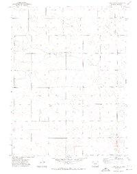
Rock Creek winds through this section of Yuma County, defining the primary drainage for a landscape shaped by agricultural and industrial utility in the early 1970s. The map illustrates a sparse but deliberate settlement pattern typical of the High Plains, where remote community centers like Pleasant Valley Ch and Buffalo Grass Ch served as the social anchors for surrounding homesteads. Evidence of local industry is visible through the mapping of a Gravel Pit and numerous water wells, which were vital for sustaining livestock and crops in this arid environment. The inclusion of the name Vonder suggests a specific family-held tract or localized point of interest, providing a valuable clue for genealogists and local historians tracing land ownership in the region during this era of post-war agricultural stabilization.
Find a feature on this map
7 named features on this map. Tap any name to fly to it.
Don’t see what you’re looking for? This feature index may not catch every label — zoom into the map to look around manually.
Map Details
Editions of this 1971 Clarkville SE Map
2 editions found
Other maps of this area

1954 · Sterling
USGS Topo · 1:250,000

1958 · Sterling
USGS Topo · 1:250,000

1971 · Fiddler Peak
USGS Topo · 1:24,000

1971 · Clarkville NE
USGS Topo · 1:24,000

1971 · Yuma NE
USGS Topo · 1:24,000

1971 · Old Baldy
USGS Topo · 1:24,000
1971 · Eckley NW
USGS Topo · 1:24,000

1972 · Clarkville
USGS Topo · 1:24,000

1972 · Clarkville SW
USGS Topo · 1:24,000
1972 · Yuma North
USGS Topo · 1:24,000