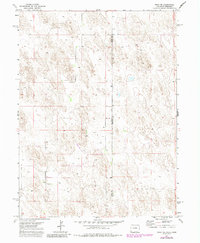
1971 Map of Wray NE
USGS Topo · Published 1985About this map
Colorado Nebraska state lines meet at the intersection of Yuma Co and Dundy Co in this 1970s survey, illustrating a remote landscape defined by high plains agriculture and resource extraction. The map captures a transition point where the eastern edge of Yuma County, Colorado, meets Dundy County, Nebraska, showing a terrain dotted with numerous Well sites that indicate the importance of water management in this arid region. The presence of the Ceres Ranch and a remote Landing Strip highlights the scale of local ranching operations and the necessity of aerial transport for connectivity. This edition, updated with 1980s data, provides a detailed look at the rural section lines and boundary markers that organized the land during a period of steady agricultural production.
Find a feature on this map
5 named features on this map. Tap any name to fly to it.
Don’t see what you’re looking for? This feature index may not catch every label — zoom into the map to look around manually.
Map Details
Editions of this 1971 Wray NE Map
3 editions found

Other maps of this area

1954 · Sterling
USGS Topo · 1:250,000

1954 · McCook
USGS Topo · 1:250,000

1957 · McCook
USGS Topo · 1:250,000

1958 · McCook
USGS Topo · 1:250,000

1958 · Sterling
USGS Topo · 1:250,000
1961 · Haigler
USGS Topo · 1:24,000

1961 · Laird
USGS Topo · 1:24,000

1961 · Wray
USGS Topo · 1:24,000

1971 · Alvin SW
USGS Topo · 1:24,000

1971 · Alvin
USGS Topo · 1:24,000