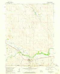
1961 Map of Haigler
USGS Topo · Published 1963About this map
The North Fork Republican River and Arikaree River converge in this high-plains landscape, forming the main stem of the Republican River just west of the town of Haigler. The settlement is closely tied to the Chicago Burlington and Quincy railroad, which runs parallel to the river valley, serving the agricultural community near the Nebraska Kansas border. This 1961 survey illustrates a sophisticated water management network, including the Haigler Canal, a Pumping Sta, and a Gaging Station used to monitor the vital flows of these prairie rivers.
Find a feature on this map
24 named features on this map. Tap any name to fly to it.
Don’t see what you’re looking for? This feature index may not catch every label — zoom into the map to look around manually.
Map Details
Editions of this 1961 Haigler Map
This is the sole edition of this map. No revisions or reprints were ever made.
Other maps of this area

1942 · St. Francis
USGS Topo · 1:62,500

1943 · St. Francis
USGS Topo · 1:62,500

1951 · St Francis
USGS Topo · 1:62,500

1954 · Limon
USGS Topo · 1:250,000

1954 · Sterling
USGS Topo · 1:250,000

1954 · McCook
USGS Topo · 1:250,000

1954 · Goodland
USGS Topo · 1:250,000

1956 · Goodland
USGS Topo · 1:250,000

1957 · McCook
USGS Topo · 1:250,000

1957 · Limon
USGS Topo · 1:250,000