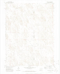
1971 Map of Wray NE
USGS Topo · Published 1974About this map
Ceres Ranch sits as the primary named outpost in this high plains borderland where the corners of Colorado and Nebraska meet. Surveyed in the early 1970s, the landscape is defined by its agricultural utility and the careful management of groundwater resources. The surface is dotted with numerous wells, marking a reliance on subterranean aquifers to support life and industry in an environment otherwise characterized by its undulating terrain. This map captures the administrative intersection of Yuma County and Dundy County, highlighting the remote nature of the region as it transitioned into more modern irrigation practices. The sparse distribution of man-made features underscores the vastness of the cattle and farming operations that have long shaped the identity of this tri-state vicinity.
Find a feature on this map
4 named features on this map. Tap any name to fly to it.
Don’t see what you’re looking for? This feature index may not catch every label — zoom into the map to look around manually.
Map Details
Editions of this 1971 Wray NE Map
3 editions found

Other maps of this area

1954 · Sterling
USGS Topo · 1:250,000

1954 · McCook
USGS Topo · 1:250,000

1957 · McCook
USGS Topo · 1:250,000

1958 · McCook
USGS Topo · 1:250,000

1958 · Sterling
USGS Topo · 1:250,000
1961 · Haigler
USGS Topo · 1:24,000

1961 · Laird
USGS Topo · 1:24,000

1961 · Wray
USGS Topo · 1:24,000

1971 · Alvin SW
USGS Topo · 1:24,000

1971 · Alvin
USGS Topo · 1:24,000