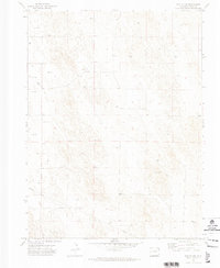
1971 Map of Eckley NW
USGS Topo · Published 1974About this map
Northeastern Colorado’s High Plains landscape is documented in this 1970s survey, showing a rural expanse primarily defined by agricultural land divisions and the infrastructure of resource extraction. The area, spanning Townships 2 and 3 North and Ranges 45 and 46 West, is characterized by a sparse distribution of landmarks, reflecting the low-density settlement patterns of Yuma County. Modern infrastructure is represented by a prominent Radio Tower and an extensive Pipeline cutting across the southern sections of the terrain. The map is peppered with numerous sites marked simply as Well, indicating the critical role of groundwater management for both ranching and domestic use in this semi-arid region. These surveyed points provide a clear view of how the land was managed and utilized during the early 1970s, before further shifts in industrial or agricultural technology.
Find a feature on this map
5 named features on this map. Tap any name to fly to it.
Don’t see what you’re looking for? This feature index may not catch every label — zoom into the map to look around manually.
Map Details
Editions of this 1971 Eckley NW Map
2 editions found
Other maps of this area

1954 · Sterling
USGS Topo · 1:250,000

1958 · Sterling
USGS Topo · 1:250,000

1961 · Eckley
USGS Topo · 1:24,000

1961 · Robb
USGS Topo · 1:24,000

1969 · Schramm
USGS Topo · 1:24,000

1971 · Yuma NE
USGS Topo · 1:24,000

1971 · Wauneta
USGS Topo · 1:24,000

1971 · Eckley NE
USGS Topo · 1:24,000

1971 · Clarkville SE
USGS Topo · 1:24,000

1971 · Old Baldy
USGS Topo · 1:24,000