
1971 Map of Old Baldy
USGS Topo · Published 1974About this map
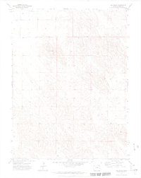
Old Baldy rises as a prominent landmark in this section of Yuma County, marking a landscape defined by its agricultural and resource management patterns. Published in the early 1970s, the map reveals a terrain characterized by dispersed infrastructure and localized water sources. Numerous sites labeled Well are scattered across the township lines, indicating the critical role of groundwater for the region's ranching or farming operations. The name Brophy appears in the southeastern section, representing one of the few named topographic or cultural markers in this relatively open area. The presence of several Wm notations suggests water management or windmill sites, further emphasizing the human adaptation to the High Plains environment. The map provides a clear record of the grid system and land divisions that shaped eastern Colorado during this era.
Find a feature on this map
6 named features on this map. Tap any name to fly to it.
Don’t see what you’re looking for? This feature index may not catch every label — zoom into the map to look around manually.
Map Details
Editions of this 1971 Old Baldy Map
3 editions found
Other maps of this area

1954 · Sterling
USGS Topo · 1:250,000

1958 · Sterling
USGS Topo · 1:250,000

1971 · Fiddler Peak
USGS Topo · 1:24,000

1971 · Wauneta NE
USGS Topo · 1:24,000

1971 · Clarkville NE
USGS Topo · 1:24,000

1971 · Yuma NE
USGS Topo · 1:24,000

1971 · Wauneta
USGS Topo · 1:24,000

1971 · Eckley NE
USGS Topo · 1:24,000

1971 · Clarkville SE
USGS Topo · 1:24,000
1971 · Eckley NW
USGS Topo · 1:24,000