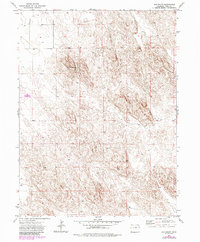
1971 Map of Old Baldy
USGS Topo · Published 1985About this map
Old Baldy rises as a prominent landmark in this northeastern Colorado landscape, anchoring a terrain defined by subtle elevation changes and an expansive, open character. The map, based on 1970s field data with mid-1980s updates, depicts a rural area where human presence is marked by a systematic grid of section lines and isolated infrastructure. Numerous wells are scattered across the quadrangle, indicating the vital importance of groundwater management for the agricultural or ranching operations of Yuma County. Other features like the Wm water markers further emphasize the technical efforts to monitor and utilize the region's resources. This survey illustrates the steady, regulated development of the High Plains, where the geometry of the township and range system—shown through T. 5 N. T. 4 N. and R. 46 W. R. 45 W.—superimposes a structured human order over the natural rises of the land.
Find a feature on this map
6 named features on this map. Tap any name to fly to it.
Don’t see what you’re looking for? This feature index may not catch every label — zoom into the map to look around manually.
Map Details
Editions of this 1971 Old Baldy Map
3 editions found
Other maps of this area

1954 · Sterling
USGS Topo · 1:250,000

1958 · Sterling
USGS Topo · 1:250,000

1971 · Fiddler Peak
USGS Topo · 1:24,000

1971 · Wauneta NE
USGS Topo · 1:24,000

1971 · Clarkville NE
USGS Topo · 1:24,000

1971 · Yuma NE
USGS Topo · 1:24,000

1971 · Wauneta
USGS Topo · 1:24,000

1971 · Eckley NE
USGS Topo · 1:24,000

1971 · Clarkville SE
USGS Topo · 1:24,000

1971 · Old Baldy
USGS Topo · 1:24,000