
1971 Map of Eckley NE
USGS Topo · Published 1974About this map
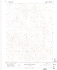
High plains terrain and a sparse network of section lines define this area of Yuma County during the early 1970s. The landscape is primarily shaped by agricultural activity and resource extraction, notably marked by the Mullison settlement and a Gravel Pit located in the northeast. Water management is a critical component of life here, as evidenced by the high density of labeled wells scattered across the land, supporting the irrigation and livestock needs of the region's farms and ranches. This 1971 survey captures a quiet period of rural development before modern shifts in agrarian technology, preserving the exact placement of local landmarks and property boundaries for those tracing regional family history or land use patterns.
Find a feature on this map
3 named features on this map. Tap any name to fly to it.
Don’t see what you’re looking for? This feature index may not catch every label — zoom into the map to look around manually.
Map Details
Editions of this 1971 Eckley NE Map
2 editions found
Other maps of this area

1954 · Sterling
USGS Topo · 1:250,000

1958 · Sterling
USGS Topo · 1:250,000

1961 · Eckley
USGS Topo · 1:24,000

1961 · Robb
USGS Topo · 1:24,000

1961 · Wray
USGS Topo · 1:24,000

1971 · Alvin SW
USGS Topo · 1:24,000

1971 · Wauneta
USGS Topo · 1:24,000
1971 · Wray NW
USGS Topo · 1:24,000

1971 · Old Baldy
USGS Topo · 1:24,000
1971 · Eckley NW
USGS Topo · 1:24,000