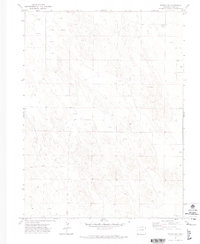
1971 Map of Eckley NE
USGS Topo · Published 1974About this map
Subsurface water resources and land management dominate the landscape of northeastern Yuma County in the early 1970s. This survey, conducted just before a period of significant agricultural expansion, reveals a terrain defined more by what lies beneath the surface than what is built upon it. Numerous irrigation and stock wells, including 3809 Well and Well 3719, are scattered across the quadrangle, illustrating the vital role of the Ogallala Aquifer in sustaining this high plains region. Settlement is extremely sparse, with Mullison standing as the primary named locale.
Find a feature on this map
17 named features on this map. Tap any name to fly to it.
Don’t see what you’re looking for? This feature index may not catch every label — zoom into the map to look around manually.
Map Details
Editions of this 1971 Eckley NE Map
2 editions found
Other maps of this area

1954 · Sterling
USGS Topo · 1:250,000

1958 · Sterling
USGS Topo · 1:250,000

1961 · Eckley
USGS Topo · 1:24,000

1961 · Robb
USGS Topo · 1:24,000

1961 · Wray
USGS Topo · 1:24,000

1971 · Alvin SW
USGS Topo · 1:24,000

1971 · Wauneta
USGS Topo · 1:24,000

1971 · Eckley NE
USGS Topo · 1:24,000
1971 · Wray NW
USGS Topo · 1:24,000

1971 · Old Baldy
USGS Topo · 1:24,000