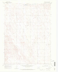
1969 Map of Vernon NW
USGS Topo · Published 1972About this map
The North Fork Republican River cuts through the northern edge of this Yuma County landscape, defining a narrow corridor of drainage in an otherwise arid expanse of eastern Colorado. Surveyed in the late 1960s, the terrain is characterized by numerous wells and intermittent water features, indicating a reliance on groundwater for the region's agricultural operations. Evidence of localized aviation is unusually prominent for such a sparsely populated area, with private facilities like the Lundvall Brothers Landing Field, Stultz Landing Field, and the Dickson Landing Strip situated across the plains. Large areas of shifting earth are noted by dune labels, suggesting a specialized environment where topography was carefully mapped by photogrammetric methods from aerial photographs.
Find a feature on this map
6 named features on this map. Tap any name to fly to it.
Don’t see what you’re looking for? This feature index may not catch every label — zoom into the map to look around manually.
Map Details
Editions of this 1969 Vernon NW Map
2 editions found

Other maps of this area

1954 · Limon
USGS Topo · 1:250,000

1954 · Sterling
USGS Topo · 1:250,000

1957 · Limon
USGS Topo · 1:250,000

1958 · Limon
USGS Topo · 1:250,000

1958 · Sterling
USGS Topo · 1:250,000

1961 · Eckley
USGS Topo · 1:24,000

1961 · Robb
USGS Topo · 1:24,000

1963 · Vernon
USGS Topo · 1:24,000

1963 · Wildcat Canyon
USGS Topo · 1:24,000

1968 · Abarr SE
USGS Topo · 1:24,000