1963 Map of Vernon
USGS Topo · Published 1965About this map
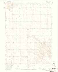
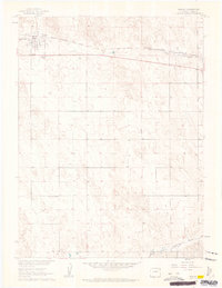
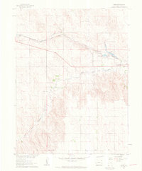
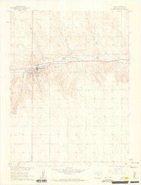
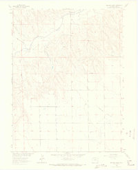
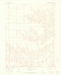
Vernon serves as the primary settlement in this part of Yuma County, positioned at a crossroads where the high plains meet the intricate drainage systems of the Republican River basin. The landscape is defined by the deep incisions of the North Fork and South Fork, which converge towards the eastern edge of the quadrangle near Black Wolf Creek. This 1963 field-checked survey reveals an agricultural community reliant on groundwater, evidenced by numerous wells scattered across the township sections. Local landmarks such as the Glendale Cem and a designated Landing Strip north of the town center indicate the established social and logistical infrastructure of the mid-20th century. The presence of multiple Spring and Springs labels along the breaks and canyon floors highlights the critical role of surface water in an otherwise semi-arid environment, shaping the placement of early homesteads and ranching boundaries.
Find a feature on this map
9 named features on this map. Tap any name to fly to it.
Don’t see what you’re looking for? This feature index may not catch every label — zoom into the map to look around manually.
Map Details
Editions of this 1963 Vernon Map
This is the sole edition of this map. No revisions or reprints were ever made.
Other maps of this area

1954 · Limon
USGS Topo · 1:250,000

1954 · Sterling
USGS Topo · 1:250,000

1957 · Limon
USGS Topo · 1:250,000

1958 · Limon
USGS Topo · 1:250,000

1958 · Sterling
USGS Topo · 1:250,000
1961 · Eckley
USGS Topo · 1:24,000
1961 · Robb
USGS Topo · 1:24,000
1961 · Wray
USGS Topo · 1:24,000
1963 · Beecher Island
USGS Topo · 1:24,000
1963 · Beecher Island NW
USGS Topo · 1:24,000