
1963 Map of Beecher Island
USGS Topo · Published 1965About this map
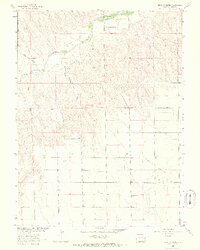
Historical Monument at Beecher Island stands as a focal point on this Yuma County landscape, commemorating the site of an 1868 battle along the Arikaree River. The topography of the early 1960s reveals a sparse, ranching-oriented environment where life followed the contours of the river and seasonal drainages like Sand Creek and Jacks Gulch. The presence of the Lansing Valley Cem and MK Ranch highlights the localized settlement patterns within the broader Lansing Valley.
Find a feature on this map
15 named features on this map. Tap any name to fly to it.
Don’t see what you’re looking for? This feature index may not catch every label — zoom into the map to look around manually.
Map Details
Editions of this 1963 Beecher Island Map
3 editions found
Other maps of this area

1950 · Bonny Reservoir
USGS Topo · 1:62,500

1954 · Limon
USGS Topo · 1:250,000

1957 · Limon
USGS Topo · 1:250,000

1958 · Limon
USGS Topo · 1:250,000

1963 · Vernon
USGS Topo · 1:24,000
1963 · Armel
USGS Topo · 1:24,000

1963 · Beecher Island NW
USGS Topo · 1:24,000
1963 · Willow Creek Ranch
USGS Topo · 1:24,000

1963 · Wildcat Canyon
USGS Topo · 1:24,000

1968 · Bonny Reservoir North
USGS Topo · 1:24,000