
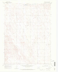
1969 Map of Vernon NW
USGS Topo · Published 1972About this map
North Fork Republican River winds through the northern portion of this High Plains landscape, a region characterized by extensive Dune formations and agricultural infrastructure. In the late 1960s, the terrain was dotted with numerous Wells, reflecting the reliance on groundwater for the surrounding farm and ranch land. Of particular note for local aviation history and genealogical research are several private airstrips associated with local families, including the Lundvall Brothers Landing Field, Stultz Landing Field, and the Dickson Landing Strip. These features, along with the detailed grid of property lines and section boundaries like the line between T. 1 S. and T. 2 S., provide a clear view of the rural development and land use patterns in Yuma County during this era.
Find a feature on this map
7 named features on this map. Tap any name to fly to it.
Don’t see what you’re looking for? This feature index may not catch every label — zoom into the map to look around manually.
Map Details
Editions of this 1969 Vernon NW Map
2 editions found
Other maps of this area

1954 · Limon
USGS Topo · 1:250,000

1954 · Sterling
USGS Topo · 1:250,000

1957 · Limon
USGS Topo · 1:250,000

1958 · Limon
USGS Topo · 1:250,000

1958 · Sterling
USGS Topo · 1:250,000

1961 · Eckley
USGS Topo · 1:24,000

1961 · Robb
USGS Topo · 1:24,000

1963 · Vernon
USGS Topo · 1:24,000

1963 · Wildcat Canyon
USGS Topo · 1:24,000

1968 · Abarr SE
USGS Topo · 1:24,000