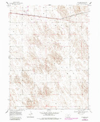
1969 Map of Schramm
USGS Topo · Published 1985About this map
Schramm and the surrounding Yuma County plains are defined by the linear corridor of the Burlington Northern railroad, which cuts across the northern reaches of this High Plains landscape. This late 1960s survey, with updates from the early 1980s, reveals a terrain primarily shaped by agricultural and resource extraction needs, evidenced by the numerous wells and a Gravel Pit dotted throughout the sections. The settlement of Schramm sits as a primary waypoint along the rail line, while further south, the Fletcher Mount Yuma area and a small Landing Strip indicate the logistical hubs necessary for rural life and navigation. The contour lines trace the subtle but distinct drainage patterns of the eastern Colorado steppe, providing a precise look at the land's elevation before modern developments shifted the local footprint.
Find a feature on this map
6 named features on this map. Tap any name to fly to it.
Don’t see what you’re looking for? This feature index may not catch every label — zoom into the map to look around manually.
Map Details
Editions of this 1969 Schramm Map
3 editions found
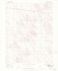
Other maps of this area

1954 · Limon
USGS Topo · 1:250,000

1954 · Sterling
USGS Topo · 1:250,000

1957 · Limon
USGS Topo · 1:250,000

1958 · Limon
USGS Topo · 1:250,000

1958 · Sterling
USGS Topo · 1:250,000

1961 · Eckley
USGS Topo · 1:24,000

1969 · Heartstrong
USGS Topo · 1:24,000

1969 · Vernon NW
USGS Topo · 1:24,000

1969 · Schramm
USGS Topo · 1:24,000

1971 · Yuma NE
USGS Topo · 1:24,000