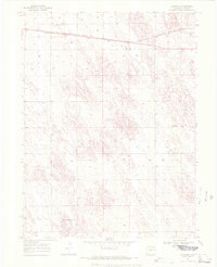
1969 Map of Schramm
USGS Topo · Published 1972About this map
Burlington Northern rails cut a direct path across the northern reaches of this high-plains landscape, serving the small settlement of Schramm. The map records a transition in the late 1960s agricultural economy, centered around irrigation and storage, with numerous wells and specialized Storage Bins scattered across the township lines. The terrain is defined by the subtle rise of Mount Yuma in the southern sections, just north of the Base Line. This survey, compiled from 1968 aerial photography, details the meticulous system of fence lines and section boundaries that organized the Yuma County prairie during a period of intensifying land use. It provides a technical record of the infrastructure supporting the region's ranching and farming heritage, from the highway designated as 34 to the survey markers such as BM 4025.
Find a feature on this map
11 named features on this map. Tap any name to fly to it.
Don’t see what you’re looking for? This feature index may not catch every label — zoom into the map to look around manually.
Map Details
Editions of this 1969 Schramm Map
3 editions found
Other maps of this area

1954 · Limon
USGS Topo · 1:250,000

1954 · Sterling
USGS Topo · 1:250,000

1957 · Limon
USGS Topo · 1:250,000

1958 · Limon
USGS Topo · 1:250,000

1958 · Sterling
USGS Topo · 1:250,000

1961 · Eckley
USGS Topo · 1:24,000

1969 · Heartstrong
USGS Topo · 1:24,000

1969 · Vernon NW
USGS Topo · 1:24,000

1969 · Schramm
USGS Topo · 1:24,000

1971 · Yuma NE
USGS Topo · 1:24,000