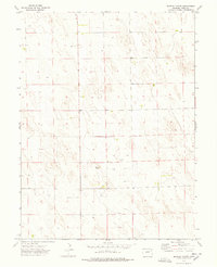
1974 Map of Beverly Grove
USGS Topo · Published 1978About this map
Beverly Grove occupies a central position within this 1974 survey of the High Plains landscape in Yuma County, Colorado. The map reveals a land defined by agricultural infrastructure and the systematic extraction of groundwater, evidenced by the numerous Well symbols scattered across the section lines. Unlike many regions where towns are dense with street grids, the settlement pattern here is sparse and functional, centered around points like the Storage Bin and individual farmsteads. The topography consists of subtle depressions and low ridges, typical of the arid eastern plains where land use is dictated by the availability of water for irrigation and livestock.
Find a feature on this map
4 named features on this map. Tap any name to fly to it.
Don’t see what you’re looking for? This feature index may not catch every label — zoom into the map to look around manually.
Map Details
Editions of this 1974 Beverly Grove Map
This is the sole edition of this map. No revisions or reprints were ever made.
Other maps of this area

1954 · Limon
USGS Topo · 1:250,000

1954 · Sterling
USGS Topo · 1:250,000

1957 · Limon
USGS Topo · 1:250,000

1958 · Limon
USGS Topo · 1:250,000

1958 · Sterling
USGS Topo · 1:250,000

1968 · Abarr SE
USGS Topo · 1:24,000

1969 · Heartstrong
USGS Topo · 1:24,000

1969 · Schramm
USGS Topo · 1:24,000

1972 · Otis SE
USGS Topo · 1:24,000

1972 · Yuma South
USGS Topo · 1:24,000