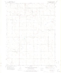
1972 Map of Clarkville SW
USGS Topo · Published 1975About this map
The Red Willow Community Center serves as a lone hub for this rural stretch of northeastern Colorado, mapped here in the early 1970s. Located in Yuma County, the landscape is defined by the ephemeral drainages of Coyote Creek, Willow Creek, and Rock Creek, which cut across the high plains. The density of wells scattered across the township lines indicates the critical importance of groundwater for the local agricultural economy and livestock operations. This map illustrates the intersection of several named creeks, such as Surveyor Creek, providing a detailed look at the hydrology and land management of the region before modern large-scale developments. The presence of a substation near the western edge of the survey area highlights the infrastructure supporting these remote homesteads and ranching communities.
Find a feature on this map
7 named features on this map. Tap any name to fly to it.
Don’t see what you’re looking for? This feature index may not catch every label — zoom into the map to look around manually.
Map Details
Editions of this 1972 Clarkville SW Map
2 editions found
Other maps of this area

1954 · Sterling
USGS Topo · 1:250,000

1958 · Sterling
USGS Topo · 1:250,000

1971 · Clarkville NE
USGS Topo · 1:24,000

1971 · Yuma NE
USGS Topo · 1:24,000

1971 · Clarkville SE
USGS Topo · 1:24,000

1972 · Clarkville
USGS Topo · 1:24,000

1972 · New Haven
USGS Topo · 1:24,000

1972 · Hyde
USGS Topo · 1:24,000

1972 · Lone Star
USGS Topo · 1:24,000

1972 · Clarkville SW
USGS Topo · 1:24,000