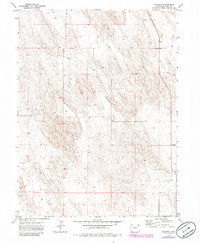
1971 Map of Wauneta
USGS Topo · Published 1985About this map
Wauneta represents a quiet pocket of eastern Colorado, documented during a period of transition in the early 1970s and updated with aerial data in the 1980s. The landscape of Yuma County is defined here by its agricultural utility and semi-arid terrain, where a high density of irrigation infrastructure is apparent. Numerous sites marked simply as Well are scattered across the quadrangle, indicating the critical importance of groundwater to the local economy and survival in this high plains region. While the small settlement of Wauneta serves as the focal point, the map primarily illustrates the expansive, organized grid of land use and the subtle topographic variations that characterize the area's geography.
Find a feature on this map
3 named features on this map. Tap any name to fly to it.
Don’t see what you’re looking for? This feature index may not catch every label — zoom into the map to look around manually.
Map Details
Editions of this 1971 Wauneta Map
3 editions found
Other maps of this area

1954 · Sterling
USGS Topo · 1:250,000

1958 · Sterling
USGS Topo · 1:250,000

1971 · Alvin NW
USGS Topo · 1:24,000

1971 · Alvin SW
USGS Topo · 1:24,000

1971 · Fiddler Peak
USGS Topo · 1:24,000

1971 · Wauneta NE
USGS Topo · 1:24,000

1971 · Wauneta
USGS Topo · 1:24,000

1971 · Eckley NE
USGS Topo · 1:24,000
1971 · Wray NW
USGS Topo · 1:24,000

1971 · Old Baldy
USGS Topo · 1:24,000