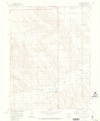
1971 Map of Hale Ponds
USGS Topo · Published 1973About this map
The South Fork Republican River winds through this high-plains landscape on the Colorado-Kansas border, defining a corridor of riparian activity amidst the surrounding dry tablelands. In the early 1970s, the South Republican Management Area anchored the region’s conservation efforts, centered around Hale Ponds and the nearby Picnic Area. The map reveals a sparse but established network of rural life, where the community of Armel is represented by its namesake Armel Ch and the neighboring Gilstrap Cem.
Find a feature on this map
22 named features on this map. Tap any name to fly to it.
Don’t see what you’re looking for? This feature index may not catch every label — zoom into the map to look around manually.
Map Details
Editions of this 1971 Hale Ponds Map
This is the sole edition of this map. No revisions or reprints were ever made.
Other maps of this area

1942 · St. Francis
USGS Topo · 1:62,500

1943 · St. Francis
USGS Topo · 1:62,500

1950 · Bonny Reservoir
USGS Topo · 1:62,500

1951 · St Francis
USGS Topo · 1:62,500

1952 · St Francis 3
USGS Topo · 1:62,500

1954 · Limon
USGS Topo · 1:250,000

1954 · Goodland
USGS Topo · 1:250,000

1956 · Goodland
USGS Topo · 1:250,000

1957 · Limon
USGS Topo · 1:250,000

1957 · Goodland
USGS Topo · 1:250,000