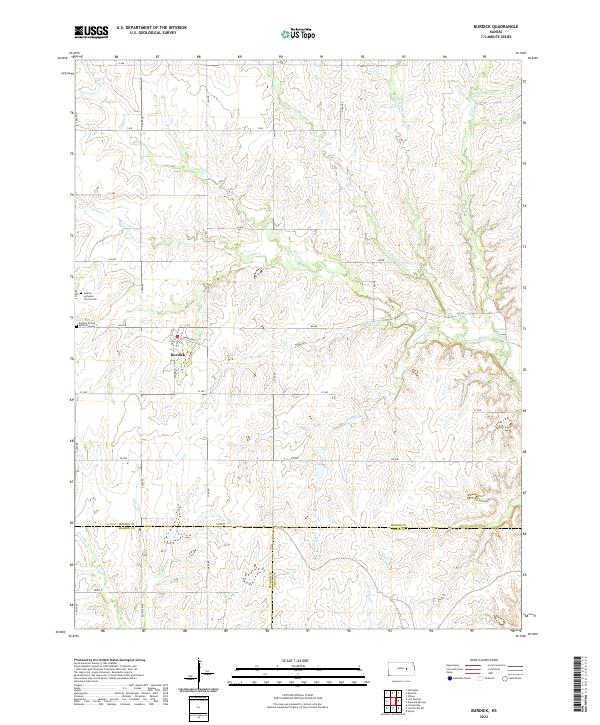
2022 Map of Burdick
USGS Topo · Published 2022About this map
Burdick serves as the central hub of this agricultural landscape in the Kansas Flint Hills, situated near the intersection of the Morris and Marion county lines. The community is anchored by local institutions such as the Burdick United Methodist church and the nearby Hebron Lutheran Church and its associated Cemetery. This 2022 survey captures a rural environment defined by an extensive network of creeks and springs that feed into larger drainage systems. Significant water features include Diamond Spring and the meandering paths of Sixmile Creek, Threemile Creek, and Mulberry Creek. The road system follows a strict township and range grid with designations like BB Avenue and South 2800 Road, reflecting the organized land division of the prairie. The convergence of Morris and Chase counties in the southeastern quadrant highlights the transition between these local jurisdictions in a landscape still dominated by open range and watercourses like Middle Creek.
Find a feature on this map
45 named features on this map. Tap any name to fly to it.
Don’t see what you’re looking for? This feature index may not catch every label — zoom into the map to look around manually.
Map Details
Editions of this 2022 Burdick Map
This is the sole edition of this map. No revisions or reprints were ever made.
Other maps of this area

1889 · Parkerville
USGS Topo · 1:125,000

1894 · Parkerville
USGS Topo · 1:125,000

1898 · Cottonwood Falls
USGS Topo · 1:125,000

1955 · Hutchinson
USGS Topo · 1:250,000

1957 · Hymer
USGS Topo · 1:24,000

1959 · Hutchinson
USGS Topo · 1:250,000

1970 · Lincolnville NE
USGS Topo · 1:24,000
1971 · Lincolnville
USGS Topo · 1:24,000

1972 · Wilsey
USGS Topo · 1:24,000
1972 · Burdick
USGS Topo · 1:24,000