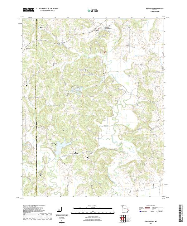
2021 Map of Burfordville
USGS Topo · Published 2021About this map
Burfordville Covered Bridge spans the waters near the northern border of this Missouri landscape, anchoring a region defined by the winding course of Upper Whitewater Creek. The terrain is marked by a high density of family and community burial sites, including the Gravel Hill Cem, Allen Cem, and Crump Cem, which provide essential touchpoints for genealogical research in this part of Cape Girardeau and Bollinger Counties.
Find a feature on this map
107 named features on this map. Tap any name to fly to it.
Don’t see what you’re looking for? This feature index may not catch every label — zoom into the map to look around manually.
Map Details
Editions of this 2021 Burfordville Map
This is the sole edition of this map. No revisions or reprints were ever made.
Other maps of this area

1922 · Cape Girardeau
USGS Topo · 1:62,500

1924 · Cape Girardeau
USGS Topo · 1:62,500

1933 · Marble Hill
USGS Topo · 1:62,500

1934 · Morley
USGS Topo · 1:62,500

1934 · Advance
USGS Topo · 1:62,500

1937 · Marble Hill
USGS Topo · 1:62,500

1939 · Morley
USGS Topo · 1:62,500

1939 · Advance
USGS Topo · 1:62,500

1949 · Paducah
USGS Topo · 1:250,000

1950 · Paducah
USGS Topo · 1:250,000