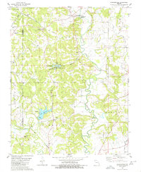
1980 Map of Burfordville
USGS Topo · Published 1980About this map
Bollinger Mill State Park and its landmark Covered Bridge anchor the northern landscape of this Missouri quadrangle, situated where the Whitewater River winds through the border of Bollinger and Cape Girardeau counties. The topography reflects a transition from the agricultural bottomlands near Burfordville to the complex water systems further south. Central to this area is a unique cluster of smaller reservoirs including Cypress Lake, Lake Cedar, and Little Pine Lake, alongside the larger Lake Girardeau which features a public Boat Ramp.
Find a feature on this map
45 named features on this map. Tap any name to fly to it.
Don’t see what you’re looking for? This feature index may not catch every label — zoom into the map to look around manually.
Map Details
Editions of this 1980 Burfordville Map
This is the sole edition of this map. No revisions or reprints were ever made.
Other maps of this area

1922 · Cape Girardeau
USGS Topo · 1:62,500

1924 · Cape Girardeau
USGS Topo · 1:62,500

1933 · Marble Hill
USGS Topo · 1:62,500

1934 · Morley
USGS Topo · 1:62,500

1934 · Advance
USGS Topo · 1:62,500

1937 · Marble Hill
USGS Topo · 1:62,500

1939 · Morley
USGS Topo · 1:62,500

1939 · Advance
USGS Topo · 1:62,500

1949 · Paducah
USGS Topo · 1:250,000

1950 · Paducah
USGS Topo · 1:250,000