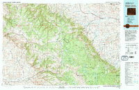
1970 Map of Burgess Junction
USGS Topo · Published 1979About this map
The Bighorn Mountains dominate this landscape, rising sharply from the eastern plains where the Tongue River valley supports the established towns of Ranchester, Dayton, and Monarch. This 1970s compilation reflects the high-country recreation and industrial utility of the Bighorn National Forest, showing the critical mountain crossroads at Burgess Junction and the rugged descent toward Shell in the west. The presence of Strip Mines and a Gravel Pit near the Burlington Northern railroad line highlights the area's ongoing extraction economy. From the high elevations of Bald Mountain and Medicine Mountain to the canyons carved by Shell Creek, the map captures a network of Pack Trails and Jeep Trails that provide access to remote landmarks like the Garden of the Gods and Steamboat Point. High-altitude water management is evident through features such as Adelaide Lake and the Fivemile Reservoir.
Find a feature on this map
87 named features on this map. Tap any name to fly to it.
Don’t see what you’re looking for? This feature index may not catch every label — zoom into the map to look around manually.
Map Details
Editions of this 1970 Burgess Junction Map
This is the sole edition of this map. No revisions or reprints were ever made.
Other maps of this area

1894 · Rosebud
USGS Topo · 1:125,000

1894 · St. Xavier
USGS Topo · 1:125,000

1895 · Dayton
USGS Topo · 1:125,000

1898 · Bald Mountain
USGS Topo · 1:125,000

1899 · Cloud peak
USGS Topo · 1:125,000

1900 · Fort McKinney
USGS Topo · 1:125,000

1901 · Rosebud
USGS Topo · 1:125,000

1901 · Cloud Peak
USGS Topo · 1:125,000

1901 · Dayton
USGS Topo · 1:125,000

1901 · St. Xavier
USGS Topo · 1:125,000