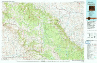
1979 Map of Burgess Junction
USGS Topo · Published 1979About this map
Bighorn National Forest dominates the western half of this landscape, where the dramatic terrain of Shell Canyon and Medicine Mountain transitions into the fertile eastern plains. The Tongue River and its numerous tributaries, including Goose Creek and Wolf Creek, carve through the foothills toward established settlements like Dayton and Ranchester. These communities serve as the gateway between the high wilderness and the industrial activity of the late 1970s, evidenced by the Burlington Northern railroad lines and active Strip Mines near Kleeburn.
Find a feature on this map
48 named features on this map. Tap any name to fly to it.
Don’t see what you’re looking for? This feature index may not catch every label — zoom into the map to look around manually.
Map Details
Editions of this 1979 Burgess Junction Map
This is the sole edition of this map. No revisions or reprints were ever made.
Other maps of this area

1894 · Rosebud
USGS Topo · 1:125,000

1894 · St. Xavier
USGS Topo · 1:125,000

1895 · Dayton
USGS Topo · 1:125,000

1898 · Bald Mountain
USGS Topo · 1:125,000

1899 · Cloud peak
USGS Topo · 1:125,000

1900 · Fort McKinney
USGS Topo · 1:125,000

1901 · Rosebud
USGS Topo · 1:125,000

1901 · Cloud Peak
USGS Topo · 1:125,000

1901 · Dayton
USGS Topo · 1:125,000

1901 · St. Xavier
USGS Topo · 1:125,000