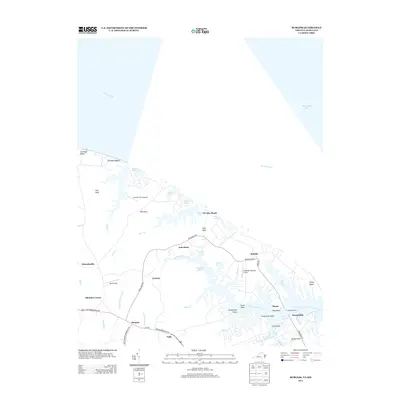
2013 Map of Burgess
USGS Topo · Published 2013About this map
The Little Wicomico River winds through the Northern Neck of Virginia as it opens into the Chesapeake Bay, defining a landscape of deep-water coves and historical landings. This 2013 survey of the area near Burgess and Jetts Store highlights the intricate shoreline where the Potomac River meets the bay. Small airports and airparks, such as Serenity Farm Airport and Jett Airpark, reflect the modern accessibility of these waterfront necks, while the Sunnybank Ferry continues to provide essential transit across the river near Bridge Neck. Settlements like Ophelia and Gonyon are connected by a network of local routes including Hacks Neck Rd and Ferry Rd. Numerous points and beaches, from Vir-Mar Beach to Flood Point, show the continued importance of the maritime environment to the local community's geography and heritage.
Find a feature on this map
53 named features on this map. Tap any name to fly to it.
Don’t see what you’re looking for? This feature index may not catch every label — zoom into the map to look around manually.
Map Details
Editions of this 2013 Burgess Map
This is the sole edition of this map. No revisions or reprints were ever made.
Other maps of this area

1894 · Point Lookout
USGS Topo · 1:62,500

1898 · St. Marys
USGS Topo · 1:125,000

1903 · Bloodsworth Island
USGS Topo · 1:62,500

1906 · St. Marys
USGS Topo · 1:125,000

1912 · Point Lookout
USGS Topo · 1:62,500

1917 · Heathsville
USGS Topo · 1:48,000

1917 · Ewell
USGS Topo · 1:62,500

1937 · Point Lookout
USGS Topo · 1:62,500
1942 · Point Lookout
USGS Topo · 1:24,000
1942 · St. George Island
USGS Topo · 1:24,000