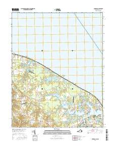
2016 Map of Burgess
USGS Topo · Published 2016About this map
Burgess and the surrounding neck lands of Northumberland County are intricately mapped along the shorelines of the Potomac River and Chesapeake Bay. This coastal landscape is defined by its numerous tidal inlets and coves, including Sawmill Cove and Hanson's Cove, which branch off the Little Wicomico River. The 2016 survey illustrates a pattern of small settlements like Ophelia, Edwardsville, and Sunnybank connected by a network of local roads such as Hacks Neck Rd and Hull Neck Rd.
Find a feature on this map
109 named features on this map. Tap any name to fly to it.
Don’t see what you’re looking for? This feature index may not catch every label — zoom into the map to look around manually.
Map Details
Editions of this 2016 Burgess Map
This is the sole edition of this map. No revisions or reprints were ever made.
Other maps of this area

1894 · Point Lookout
USGS Topo · 1:62,500

1898 · St. Marys
USGS Topo · 1:125,000

1903 · Bloodsworth Island
USGS Topo · 1:62,500

1906 · St. Marys
USGS Topo · 1:125,000

1912 · Point Lookout
USGS Topo · 1:62,500

1917 · Heathsville
USGS Topo · 1:48,000

1917 · Ewell
USGS Topo · 1:62,500

1937 · Point Lookout
USGS Topo · 1:62,500
1942 · Point Lookout
USGS Topo · 1:24,000
1942 · St. George Island
USGS Topo · 1:24,000