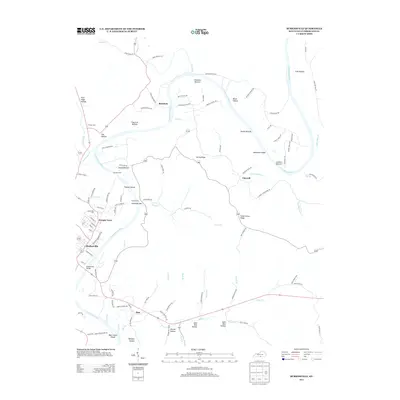
2013 Map of Burkesville
USGS Topo · Published 2013About this map
The Cumberland River carves a winding path through the center of this 2013 survey, defining the agricultural and residential layout of south-central Kentucky. Around the oxbows and fertile lowlands like Howards Bottom and Irish Bottom, the map reveals a landscape shaped by the river's influence on transportation and settlement. The city of Burkesville serves as the regional anchor, where the Burkesville Bridge provides a vital crossing point. To the north and east, smaller communities such as Bakerton, Claywell, and Dougan Town are connected by a network of rural roads that follow the ridges and hollows, including String Ridge and Smith Grove Ridge. Genealogists may find value in the location of the Burkesville Cem and Flower Cem, while topographic details like Alexander Bar and Thomas Island highlight the river's historical navigational features.
Find a feature on this map
108 named features on this map. Tap any name to fly to it.
Don’t see what you’re looking for? This feature index may not catch every label — zoom into the map to look around manually.
Map Details
Editions of this 2013 Burkesville Map
This is the sole edition of this map. No revisions or reprints were ever made.
Other maps of this area

1924 · Lillydale
USGS Topo · 1:62,500

1926 · Lillydale
USGS Topo · 1:62,500

1929 · Lillydale
USGS Topo · 1:62,500

1929 · Byrdstown
USGS Topo · 1:62,500

1953 · Breeding
USGS Topo · 1:24,000

1953 · Waterview
USGS Topo · 1:24,000

1953 · Amandaville
USGS Topo · 1:24,000

1953 · Burkesville
USGS Topo · 1:24,000

1953 · Wolf Creek Dam
USGS Topo · 1:24,000

1953 · Creelsboro
USGS Topo · 1:24,000