
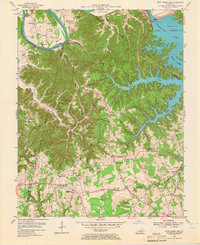
1953 Map of Wolf Creek Dam
USGS Topo · Published 1955About this map
The Wolf Creek Dam and its impounded waters define this mid-century landscape where the Cumberland River was transformed into Cumberland Lake. This survey captures the transition of the region’s topography, showing deep-cut tributaries like Guffey Creek and the West Fork of Indian Creek becoming fingers of the rising lake. Away from the water, the rugged interior is marked by numerous oil wells scattered along Agee Ridge and Diesda Ridge, signaling the era's local extractive industry.
Find a feature on this map
59 named features on this map. Tap any name to fly to it.
Don’t see what you’re looking for? This feature index may not catch every label — zoom into the map to look around manually.
Map Details
Editions of this 1953 Wolf Creek Dam Map
2 editions found
Other maps of this area

1924 · Lillydale
USGS Topo · 1:62,500

1926 · Lillydale
USGS Topo · 1:62,500

1929 · Lillydale
USGS Topo · 1:62,500

1929 · Byrdstown
USGS Topo · 1:62,500

1953 · Amandaville
USGS Topo · 1:24,000

1953 · Burkesville
USGS Topo · 1:24,000

1953 · Creelsboro
USGS Topo · 1:24,000

1953 · Jamestown
USGS Topo · 1:24,000

1954 · Frogue
USGS Topo · 1:24,000

1954 · Cumberland City
USGS Topo · 1:24,000