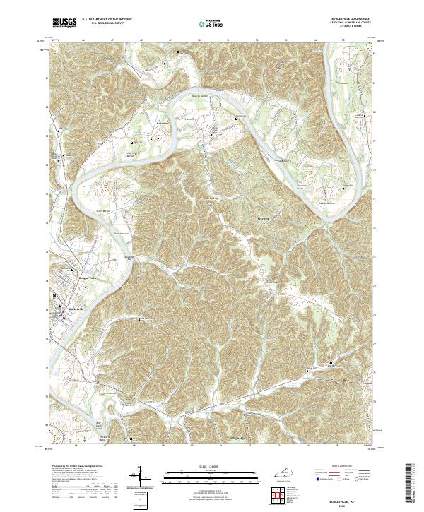
2022 Map of Burkesville
USGS Topo · Published 2022About this map
Burkesville serves as the focal point of this Cumberland County survey, situated along a prominent bend in the Cumberland River. The town layout includes the Cumberland County Courthouse and numerous local landmarks such as Dougan Town and the Burkesville Cem. The surrounding landscape is defined by the river’s meandering path, creating fertile lowlands like Howards Bottom, Scotts Bottom, and Irish Bottom.
Find a feature on this map
92 named features on this map. Tap any name to fly to it.
Don’t see what you’re looking for? This feature index may not catch every label — zoom into the map to look around manually.
Map Details
Editions of this 2022 Burkesville Map
This is the sole edition of this map. No revisions or reprints were ever made.
Other maps of this area

1924 · Lillydale
USGS Topo · 1:62,500

1926 · Lillydale
USGS Topo · 1:62,500

1929 · Lillydale
USGS Topo · 1:62,500

1929 · Byrdstown
USGS Topo · 1:62,500

1953 · Breeding
USGS Topo · 1:24,000

1953 · Waterview
USGS Topo · 1:24,000

1953 · Amandaville
USGS Topo · 1:24,000

1953 · Burkesville
USGS Topo · 1:24,000

1953 · Wolf Creek Dam
USGS Topo · 1:24,000

1953 · Creelsboro
USGS Topo · 1:24,000