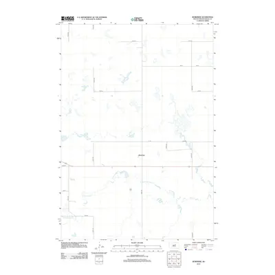
2012 Map of Burkmere
USGS Topo · Published 2012About this map
Burkmere sits at the center of this rural landscape in Faulk County, representing a quiet hub of the High Plains. The terrain is defined by the winding course of the S Fork Snake Cr, which meanders across the southern half of the quadrangle. This hydrographic pattern suggests a landscape shaped by seasonal water flow and drainage into the larger Missouri River basin. Away from the creek, a rigid grid of gravel roads, including 157th St and 341st Ave, partition the land into expansive agricultural plots. Local history is anchored at the Bass Cem, a small cemetery located south of the main settlement near the creek's edge. The map captures the enduring township-and-range geometry that continues to govern life and travel in this part of South Dakota.
Find a feature on this map
15 named features on this map. Tap any name to fly to it.
Don’t see what you’re looking for? This feature index may not catch every label — zoom into the map to look around manually.
Map Details
Editions of this 2012 Burkmere Map
This is the sole edition of this map. No revisions or reprints were ever made.
Other maps of this area

1950 · Rezac Lake NE
USGS Topo · 1:24,000

1950 · Onaka
USGS Topo · 1:24,000

1951 · Rezac Lake NE
USGS Topo · 1:24,000

1951 · Clark Lake
USGS Topo · 1:24,000

1951 · Orient NW
USGS Topo · 1:24,000

1951 · Rezac Lake NW
USGS Topo · 1:24,000

1952 · Onaka
USGS Topo · 1:24,000

1952 · Norbeck
USGS Topo · 1:24,000

1952 · Burkmere
USGS Topo · 1:24,000

1952 · Onaka SW
USGS Topo · 1:24,000