1950 Map of Onaka
USGS Topo · Published 1978About this map
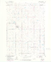
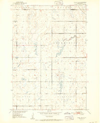
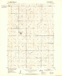
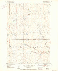
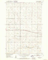
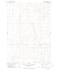
Onaka serves as the central hub of this prairie landscape, straddling the line between Sherman and Clark townships. This mid-century survey reveals a rural society structured around local education and transportation, featuring the East Sherman Sch and O'Neil Sch placed to serve the surrounding farmsteads. The physical landscape is defined by the Madison Hills and a scattering of glacial potholes and small lakes typical of the region. A notable vestige of earlier infrastructure is the Old Railroad Grade cutting east-to-west through the center of the map, indicating the shifting nature of rural transport as rail lines were pulled up in the post-war era. The survey also clearly delineates the border between Edmunds Co and Faulk Co, showing how political boundaries bisected these central South Dakota farming communities.
Find a feature on this map
10 named features on this map. Tap any name to fly to it.
Don’t see what you’re looking for? This feature index may not catch every label — zoom into the map to look around manually.
Map Details
Editions of this 1950 Onaka Map
This is the sole edition of this map. No revisions or reprints were ever made.
Other maps of this area
1951 · Clark Lake
USGS Topo · 1:24,000
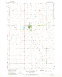
1952 · Onaka
USGS Topo · 1:24,000
1952 · Burkmere
USGS Topo · 1:24,000
1952 · Onaka SW
USGS Topo · 1:24,000

1954 · Aberdeen
USGS Topo · 1:250,000

1956 · Aberdeen
USGS Topo · 1:250,000
1965 · Onaka
USGS Topo · 1:24,000
1974 · Bowdle SE
USGS Topo · 1:24,000
1974 · Roscoe SW
USGS Topo · 1:24,000
1978 · Loyalton
USGS Topo · 1:24,000