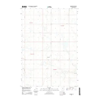
2015 Map of Burkmere
USGS Topo · Published 2015About this map
Burkmere sits at the heart of this Faulk County landscape, reflecting the grid-based agricultural development of the South Dakota prairie in the early 21st century. The terrain is defined by its subtle drainage patterns, most notably along the S Fork Snake Cr and the topographical depression of Vogeler Draw. This area maintains a strictly organized section line road system, from 157th St in the north down to 164th St in the south, which facilitates the region's ranching and farming operations. Historical continuity is marked by the presence of Bass Cem, a small burial ground located south of the main settlement area near the creek. The map reveals the characteristic prairie pothole landscape, where numerous small, seasonally wet depressions dot the plains between the established township boundaries of t118n r70w and t119n r71w.
Find a feature on this map
16 named features on this map. Tap any name to fly to it.
Don’t see what you’re looking for? This feature index may not catch every label — zoom into the map to look around manually.
Map Details
Editions of this 2015 Burkmere Map
This is the sole edition of this map. No revisions or reprints were ever made.
Other maps of this area

1950 · Rezac Lake NE
USGS Topo · 1:24,000

1950 · Onaka
USGS Topo · 1:24,000

1951 · Rezac Lake NE
USGS Topo · 1:24,000

1951 · Clark Lake
USGS Topo · 1:24,000

1951 · Orient NW
USGS Topo · 1:24,000

1951 · Rezac Lake NW
USGS Topo · 1:24,000

1952 · Onaka
USGS Topo · 1:24,000

1952 · Norbeck
USGS Topo · 1:24,000

1952 · Burkmere
USGS Topo · 1:24,000

1952 · Onaka SW
USGS Topo · 1:24,000