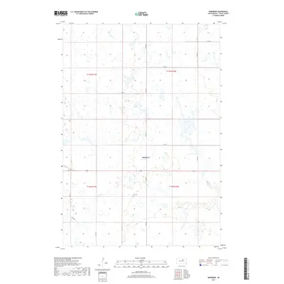
2017 Map of Burkmere
USGS Topo · Published 2017About this map
Burkmere serves as a central landmark in this prairie landscape of Faulk County, where the township and range system creates a rigid grid across the undulating terrain. The landscape is defined by the winding course of the S Fork Snake Cr and a dense concentration of small wetlands and prairie potholes that dot the sections. Local history is anchored at the Bass Cem, situated just south of the main settlement along 343rd Ave. This area of South Dakota reflects a late-20th and early-21st-century agricultural continuity, where section-line roads like 162nd St and 346th Ave provide the primary infrastructure for the scattered farmsteads. The map captures the intersection of natural drainage patterns with the formal geometry of the Public Land Survey System, illustrating how water and geography dictate the placement of local crossroads.
Find a feature on this map
16 named features on this map. Tap any name to fly to it.
Don’t see what you’re looking for? This feature index may not catch every label — zoom into the map to look around manually.
Map Details
Editions of this 2017 Burkmere Map
This is the sole edition of this map. No revisions or reprints were ever made.
Other maps of this area

1950 · Rezac Lake NE
USGS Topo · 1:24,000

1950 · Onaka
USGS Topo · 1:24,000

1951 · Rezac Lake NE
USGS Topo · 1:24,000

1951 · Clark Lake
USGS Topo · 1:24,000

1951 · Orient NW
USGS Topo · 1:24,000

1951 · Rezac Lake NW
USGS Topo · 1:24,000

1952 · Onaka
USGS Topo · 1:24,000

1952 · Norbeck
USGS Topo · 1:24,000

1952 · Burkmere
USGS Topo · 1:24,000

1952 · Onaka SW
USGS Topo · 1:24,000