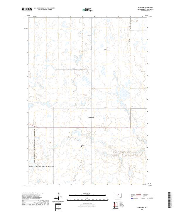
2021 Map of Burkmere
USGS Topo · Published 2021About this map
The tiny settlement of Burkmere serves as a quiet focal point in this portion of rural Faulk County, located just north of 162nd St. The landscape is defined by the winding course of the S Fork Snake Cr, which meanders through the southern half of the quadrangle. This drainage pattern, coupled with numerous small depressions and intermittent water bodies across the prairie, indicates the glaciated pothole terrain characteristic of the region.
Find a feature on this map
15 named features on this map. Tap any name to fly to it.
Don’t see what you’re looking for? This feature index may not catch every label — zoom into the map to look around manually.
Map Details
Editions of this 2021 Burkmere Map
This is the sole edition of this map. No revisions or reprints were ever made.
Other maps of this area

1950 · Rezac Lake NE
USGS Topo · 1:24,000

1950 · Onaka
USGS Topo · 1:24,000

1951 · Rezac Lake NE
USGS Topo · 1:24,000

1951 · Clark Lake
USGS Topo · 1:24,000

1951 · Orient NW
USGS Topo · 1:24,000

1951 · Rezac Lake NW
USGS Topo · 1:24,000

1952 · Onaka
USGS Topo · 1:24,000

1952 · Norbeck
USGS Topo · 1:24,000

1952 · Burkmere
USGS Topo · 1:24,000

1952 · Onaka SW
USGS Topo · 1:24,000