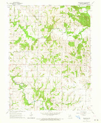
1964 Map of Burksville
USGS Topo · Published 1965About this map
Burksville serves as the focal point for this rural Shelby County landscape, surrounded by a network of family and community landmarks that defined the mid-century agricultural era. The terrain is deeply etched by the Salt River, North Tiger Fork River, and Black Creek, which create a series of winding ridges where small country churches like Old Brick Ch and Mt Zion Ch were established. These structures, along with Bethany Ch and Oak Dale Ch, suggest a settlement pattern where social life centered on localized congregations within the townships of Bethel and Tiger Fork.
Find a feature on this map
24 named features on this map. Tap any name to fly to it.
Don’t see what you’re looking for? This feature index may not catch every label — zoom into the map to look around manually.
Map Details
Editions of this 1964 Burksville Map
This is the sole edition of this map. No revisions or reprints were ever made.
Other maps of this area

1903 · Palmyra
USGS Topo · 1:125,000

1948 · Quincy
USGS Topo · 1:250,000

1953 · Moberly
USGS Topo · 1:250,000

1954 · Moberly
USGS Topo · 1:250,000

1956 · Quincy
USGS Topo · 1:250,000

1957 · Moberly
USGS Topo · 1:250,000

1959 · Shelbina
USGS Topo · 1:24,000

1959 · Lakenan
USGS Topo · 1:24,000

1959 · Hunnewell
USGS Topo · 1:24,000

1960 · Moberly
USGS Topo · 1:250,000