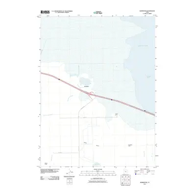
2011 Map of Burmester
USGS Topo · Published 2011About this map
Great Salt Lake dominates the northern reaches of this landscape, its waters meeting the mainland at Fremont Strait. The settlement of Burmester sits at a critical junction in the Tooele Valley, positioned where the infrastructure of Frontage Rd and Burmester Rd navigate a complex hydrologic network. The terrain is defined by its transition from high-desert features like Coyote Knolls and Dead Man Gulch to the saturated lowlands of Warm Springs Slough and Cooleys Slough. These wetland areas, including the Willow Fields and Blue Lakes, indicate a delicate environmental balance between the arid valley floor and the brackish influence of the lake. Local infrastructure like Higley Rd and Meadow Ln provide access to these scattered water features and the alluvial plains of Sixmile Creek.
Find a feature on this map
15 named features on this map. Tap any name to fly to it.
Don’t see what you’re looking for? This feature index may not catch every label — zoom into the map to look around manually.
Map Details
Editions of this 2011 Burmester Map
This is the sole edition of this map. No revisions or reprints were ever made.
Other maps of this area

1885 · Tooele Valley
USGS Topo · 1:250,000

1953 · Tooele
USGS Topo · 1:250,000

1955 · Timpie
USGS Topo · 1:62,500

1955 · Mills Junction
USGS Topo · 1:24,000

1955 · Burmester
USGS Topo · 1:24,000

1955 · Grantsville
USGS Topo · 1:24,000

1955 · Tooele
USGS Topo · 1:250,000

1955 · Tooele
USGS Topo · 1:24,000

1968 · Plug Peak SE
USGS Topo · 1:24,000

1968 · Corral Canyon
USGS Topo · 1:24,000